

THE CLOUDS COME FIERCE - WDP END
- mandog
- Sep 3, 2019
- 11 min read

Updated: Sep 3, 2019
Chronicling the ferocious path of Hurricane Dorian Tuesday September 03, 2019

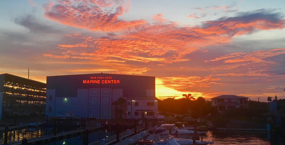
I look outside to the edges of a monster as it slowly passes by. Knowing the full brunt of its fury is still presently overtop the northern edge of the Bahamas, I remain in a state of awe and usual amount of wonder due to the forces of nature. I watch through my porch as the feeder bands make their routine arrivals, continuing to sweep across the state of Florida every thirty minutes or so. More than two days have gone by since Hurricane Dorian initially struck the outer islands of Abacos, beginning with the areas of Hope Town and Marsh Harbor.
After making landfall as a CAT 5 storm with sustained winds of 185 mph, gusts of 220 and a central pressure of 910 mb, it pummeled the small island nation that, in most places, barely rises above ten feet in elevation. It has dumped unfathomable amounts of rain and swept rolling tides of ocean right up to the windows of second story residents. Those who are without a second story, are under twenty feet of water and far from help. Since Monday (9/02), the Coast Guard have been flying rescue missions in their MH-60 Jayhawk helicopters to extract critically injured persons. Their efforts cannot be praised enough.

Throughout this storm, I made a decision to stay put. I waited with anxious anticipation of each update at 8AM, 11AM, 5PM and 11PM. I tracked the storms intensity, movement, central pressure and direction of travel (which has been close to nil since entering the island chain). I had radar imagery displayed non-stop, while also observing GeoSatelite footage that detailed the storms organization and intensification efforts, which it did quite well.
Dorian became the strongest storm to ever to make landfall in the Bahamas and is tied with a slew of other storms for the second strongest storm in the Atlantic since modern, reliable records of cyclones were kept. (1851 — now, 168 yrs)

My last bout with a tropical cyclone, was Hurricane Irma which, in 2017, developed into a CAT 5 storm and struck the lower to middle keys at full intensity. This too would be a record breaking storm with 180 mph sustained winds, peak central pressures of 914 mb and damages for the state estimated at $50 billion, surpassing Hurricane Andrew of 1992 as the costliest storm its ever seen. It ravished Florida and kept us guessing for which side it would choose. It inevitably decided upon the Western/Gulf side and tore through the entire state finally finishing in Memphis, TN.
Unfortunately, in the build up to Irma, I learned quite quickly what its like to be surrounded by people in a state of panic. Without delay, once Florida became projected to be in line with the path of this storm, the grocery stores began to fill while the shelves began to empty. Near every gas station had ran out of fuel. The one’s that still had it, had cars lined up for miles with wait times of over two hours and no guarantee of if any fuel would be left when it was your turn. There wasn't a wing nut or piece of plywood left in any store. The hotels from Florida to Georgia were without occupancy and the roads were packed with cars fleeing, possessions strapped to their roofs. All this, and we were still two weeks out from the storm. It was total chaos.
Stories of looters breaking in, riots in the water lines, price gauging, preying upon the weak took to what climbed the ranks in what the news agencies decided to showcase. This image of our state's people turning against one another and fending for themselves became sealed in my mind and now, for this weather event, I chose to steer clear of any of those heated battle arenas.
Luckily for me, I had a nine day trip for twelve people to the Bahamas brought to a halt and had plenty of food to divvy up. I brought with me enough water and began freezing jugs of it in the event that the power did go out. I already had a full tank of gas and drove my vehicle home after the day spent securing the boat. I told myself I had everything I needed, there was nothing for me out there and not to move unless absolutely necessary.
Beyond the scope of encountering a panicked, craze-driven horde of people that would chance steal my car or injure me for a pack of batteries, I also felt a timidness to leave my stronghold for fear it would evoke the attention of this furious, continuously dubbed “catastrophic and life threatening” hurricane that was spinning, cringe-worthingly close to our state. I felt that if for one second it saw me out galavanting around, looking for a shop to sell me some ice cream because I deferred my judgments to stay inside, that this menacing, howling, monster would take the marginal 100 mile jump to the west and deliver to us what it had to the Bahamas.

My preliminary instincts were telling me that, if it were to strike the coast of Florida, it would likely miss us by about sixty miles to the North. That alone could take us out of the range for hurricane force winds. It was a tight margin to play with, but I felt confident in my assessment. Of course, the funny thing about projections and models, is they are based on its present activity and movement. From one update to the next, it continues to evolve and very seldom does the initial track of the storm hold. Still, I had enough sense of security to stay put and watch it all unfold. The instincts proved right, and not only did it avoid making a direct landfall, but it missed the state entirely, sweeping up the Atlantic coast and giving only a hint of its presence to the bated and awaiting residents.
The morning after it made landfall and spent the entire day and night pounding the Abacos, I remember the odd sensation of opening up my doors and smelling this storm. I detected a sense of mustiness to the air. A staleness, like that of old, damp rags. Inside I recoiled a bit, as I believed it to be the literal sweat and tears from the faces of those poor Bahamians who were living out this nightmare. The essence of their flooded, drowned-out lives that were being ripped apart, sucked high up into the swirling, broiling mass that was above them.
I stood there and soaked up these smells wondering what exactly it was like to be 100 miles East and hear those shrieking winds tearing at the the thin, pliable materials that kept you from it. A long while ago, I conceptually had a go at exploring the notion of just what “inside” meant. You have this, wall.... between you and everything else. And your neighbors have one, and your neighbors neighbors have one, but just what is so special about this wall that it can conditionally separate you from the outside world? We tell ourselves that we’re going inside, or we’re safe in there, but where are we when a storm hits or an earthquake shakes loose those walls? We are once again, exposed to the irony of it all, that we never left the outside. I realized I am always, in some way, neither in nor out of it. I am just apart of. Seems way too philosophical of an approach for considering walls, but I get that false sense of constructed reality in these type scenarios. That there is nothing stopping the outside world from getting in. Not guns, not hurricane glass windows, not seismically built foundations.
We are always at play in nature
During Irma I learned to respect the power of hurricanes. The seemingly simple forces of wind and rain, well, they compound over time and the scientists are not wrong in their assessments that we are entering a time of uncertainty with the recent surge of strength in Atlantic-based storms. All of my stories like to include harrowing tales of ships encountering the worst of seas with silent, rogue assassins and the most tumultuous tyrants of the skies. Its just something I'm fascinated by.
This change in weather marks a new era, where oceans and storms rage without limits, but we are challenging its forces with rapid advancements in technology. GeoSatelites are now providing accurate and detailed, round-the-clock information of sea states and formations of weather systems. Before this, we had to actually fly planes around the world in order to detect, monitor and feasibly attempt to predict these disturbances half an ocean away. We’ve come a long way in forecasting for hurricanes. Next, we need to advance early warning detection for earthquakes and tsunamis. The areas in peril are still without any notice of these events, and having lived through both hurricanes and earthquakes of the greatest degree, this story is a testament to where I can hedge my bets and where I simply cannot.
I encourage everyone to stay informed, not just by the news agencies but to dig deeper, find out where their information comes from. I spent a lot of time this event researching how we get our weather information. Learning about the Hurricane Hunter squadrons that fly into the middle of the worlds worst storms to gather analysis of its strength and direction of travel. Their efforts save the lives and economies of thousands of people with every mission.
Lastly, with the storm having finally weakened to the state of a CAT 2 and am now within the more tolerable SW quadrant of the storm, I leave you all with some links to various resources I used while chronicling the storm and also some pages to make charitable contributions through. My thoughts and prayers go out to those in the Bahamas that were affected by this storm. They are a beautiful and resilient island nation that, since a young kid, has instilled in me my true pirated nature.
I wish them all the best in a speedy recovery and look forward to working together again soon! Thanks for reading and as always, be on the lookout for more fun and adventure!
A fan page for the USAF’s 53rd Weather Reconnaissance Squadron
A daring brush with disaster during a recon flight through Hurricane Hugo
Interactive and animated map sequences are by far one of my favorite and most utilized tools. With these I can, without any sense of meteorology, get an idea for how strong and where storms are headed. The tools I use most are:
ZOOM.EARTH
A great and interactive static satellite imagery tool that tracks storms and weather.
MY RADAR
The go-to weather app for storm radars and information regarding natural disasters like earthquakes, fires and hurricanes. Reports come direct from the government agencies of NOAA, USGS and NIFC. I use this app daily!
NOAA GOES SATELLITE
The GOES satellite creates looped sequences for anywhere in the world. Use the index to find your region, or choose “Storms” from the menu.
Using the GEO-COLOR regional format, I prefer to set it up with longer (4-6 hr) loops and then take downloads of the images as I go. For example:
Hurricane Relief for Elbow Cay (Abacos)
Full Charity Index for all of the Bahamas


(SLIDE SHOW: original track, return to FL, haul out, storm at its peak)
11AM Wednesday August 28, 2019 (ts) Presently due East of Puerto Rico, forecasts show tropical storm Dorian organizing into a hurricane later this day. Expected to move in a WNW heading, this put Florida into a zone of direct impact. TS force winds expected to arrive in three days time.
Upon the hour of this notice, we inform guests that we are making the decision to leave the Bahamas and begin our 66 mile trek back to West Palm Beach.
2PM Wednesday August 28, 2019 (cat 1) Halfway into the crossing, TS Dorian became a CAT 1 hurricane.
Sustained winds: 75 mph, central pressure: 997 mb
Moving: NW 315º at 13 mph
8PM Wednesday August 28, 2019 (cat 1)
Having cleared customs and with the dock lines on, guests and passengers begin quickly assembling their plan for leaving the state. In the sky, the 53rd Airborne has flown a reconnaissance mission into the storm and determined it is strengthening and that the eye wall is solidifying. Sustained winds: 85 mph, central pressure: 986 mb
90 miles N of Puerto Rico over open ocean, moving: NW 320º at 13 mph
11AM Friday August 30, 2019 (cat 2) The R/V Stenella has successfully been hauled out of the water, blocked low to the ground to allow for minimal airflow and topsides lashed and secured.
USAF reconnaissance mission expects storm will become a major CAT 3 hurricane later this day. Sustained winds: 110 mph, central pressure: 972 mb
660 miles East of West Palm Beach, moving: NW 310º at 10 mph
11PM Friday August 30, 2019 (cat 4) Storm has rapidly intensified into a CAT 4 storm. Expected arrival for Bahamas is early Sunday and landfall on the coast of Florida late Monday.
Sustained winds: 140 mph, central pressure: 948 mb
545 miles East of West Palm Beach, moving: WNW 300º at 10mph
8AM Saturday August 31, 2019 (cat 4)
Reconnaissance flight revealed further intensification and expects a slower, more westward movement towards the Bahamas.
Sustained winds: 145 mph, central pressure: 944 mb
445 miles East of West Palm Beach
8PM Saturday August 31, 2019 (cat 4)
Scattered pops of rain begin in Florida. Continues as a CAT 4 storm.
Sustained winds: 150 mph, gusts: 185 mph
335 miles East of West Palm Beach
8AM Sunday September 01, 2019 (cat 5)
Became a CAT 5 overnight. Reconnaissance flights reveal storm is still continuing to intensify as eye wall approaches Abaco Islands.
Sustained winds: 175 mph, central pressure: 922 mb
225 miles East of West Palm Beach, moving: W 275º at 8 mph
11AM Sunday September 01, 2019 (cat 5) Eye wall makes landfall on Hope Town/Elbow Cay (Abacos) as the strongest storm on record for Northwestern Bahamas. Storm surge: 18-23 ft
Sustained winds: 180 mph, gusts of 220 mph, central pressure: 913 mb
205 miles East of West Palm Beach, moving: W 270º at 7 mph
5PM Sunday September 01, 2019 (cat 5) Eye of the Storm is crawling across Abaco islands at 5 mph
Max sustained winds: 185 mph, gusts: 200 mph, central pressure: 910 mb
Hurricane warning issued from Jupiter to Vero
8PM Sunday September 01, 2019 (cat 5) Outer bands have reached the Florida coast
Locally - Gusts over 30 mph
Storm winds continue at sustained: 185 mph, 915 mb central pressure
155 miles East of West Palm Beach
11PM Sunday September 01, 2019 (cat 5) Storm has made landfall on Grand Bahama Island, still a CAT 5
Sustained winds: 180 mph, central pressure: 914 mb
135 miles East of West Palm Beach, moving: W 275º at 6 mph
8AM Monday September 02, 2019 (cat 5)
The air held a scent of old, musty rags. Almost like you could detect the smells of all its turmoil, still swirling around in its chaotic clouds.
Overnight very little movement happened. Continuing on a Westerly course, but at a near stalled speed of 0-1 mph. Sustained winds dropped to 160 mph, but gusts are still in the 200s. Extreme destruction is expected throughout the day.
120 miles East of West Palm Beach
11AM Monday September 02, 2019 (cat 4) Storm has stalled over Northern Bahamas. Sustained winds have dropped to 155 mph, making it a CAT 4, but at the highest level of its ranges.
110 miles East of West Palm Beach
2PM Monday September 02, 2019 (cat 4) Beginning to resume a WNW heading of 285º at 1 mph
Sustained winds: 150 mph, central pressure 938 mb
105 miles East of West Palm Beach
8PM Monday September 02, 2019 (cat 4) Storm has stalled, zero movement. Locally — Heavy feeder band rains
Sustained winds: 140 mph, central pressure: 942 mb
105 miles East of West Palm Beach
11PM Monday September 02, 2019 (cat 4) Heavy downpour flashes continue at regular sweeping intervals
Juno Beach, FL recorded sustained wind of 44 mph, gusts of 56 mph
Sustained winds: 132 mph, central pressure: 946 mb
100 miles East of West Palm Beach, moving: N 360 º at 0 mph
8AM Tuesday September 03, 2019 (cat 3)
The all clear has been given. Dropped to a CAT 3 overnight
Sustained winds: 120 mph, central pressure: 954 mb
110 miles ENE of West Palm Beach, moving: NW 310º at 1 mph
11AM Tuesday September 03, 2019 (cat 2)
Storm has reduced in its intensity, now a CAT 2, but is growing in size
Sustained winds: 109 mph, central pressure 955 mb
105 miles East of Fort Pierce, moving: NW 320º at 2 mph


Thank you for the contribution links. Your perspective was very interesting as one who had endured the chaos of Hurricane Irma. Actually, Hurricane Hugo is also on your resume.